|
USK
WALKS
|

|
|
|||||||
| HOMEPAGE |
|
Walk No 19: Pentwyn
Farm - Llandenny - Llangeview - Usk Flood Route Boots are essential
for this walk as stretches of it are often very muddy. |
||
|
|
||
|
|
|
|
|
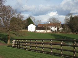
Follow closely the wire fence and hedge on the right and cross a stile hidden behind bushes at the overgrown corner of the field. Turn half right, immediately passing a long, wooden building, and head for a large tree at the corner of the field. Cross a stile, go straight down the field and cross a stile 30 metres to the left of a telegraph pole. Cross two small footbridges, turn right, following the stream for 20 metres, then turn left on a narrow, indistinct path. Go uphill through the trees. Head for the large trees at the end of the plantation, to reach a stile between the 2 largest trees. (Note that from the second footbridge to this stile there is no clearly defined path and it can be very overgrown at times!) Turn left on the lane, ignoring the private drive to Cefn Tilla Court. |
||
|
After about 1 km pass the main entrance to Cefn
Tilla Court on the left and shortly cross a
stile on the right at a waymark post just after a large tree. Follow the
signposted direction and cross a stile. Go straight on with a hedge on
the left. Go through a metal gate and head for the far left corner of
the next field. Cross 2 adjacent stiles on the left and follow the hedge
on the right round to a metal gate. Turn right on the lane (in Llandenny
village) and continue on a track, soon crossing a dual carriageway (A449). |
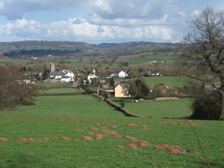
Llandenny |
|
|
At the end of the track cross a brook and go through a metal gate. Turn half right and head for 2 short, grey walls to the left of tall trees at the field boundary. Go through 2 metal gates and turn right into the South Wales Gliding Club's field. Take extreme care when there is gliding activity in progress. |
||
|
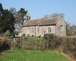
Just before the dual carriageway turn left on a lane. Continue on this, ignoring a minor lane on the left at a bend. Continue on the lane beyond a short track leading to the disused St David's Church (always left open for visitors) and turn right at the crossroads (signposted Usk). Follow this to the T-junction by the Olway Inn and turn left. Follow the road back to the town square. |
||
|
A
laminated A5 card showing this walk route, along with photographs, can
be easily ordered here.
The walk can be ordered more cheaply in digital format (PDF file) on the alternative Order Form. |
return
to top >>>
Page last updated 25.04.25