|
USK
WALKS
|

|
|
|||||||
| HOMEPAGE |
|
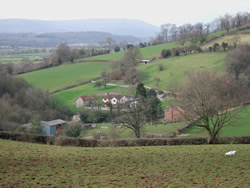
Walk No 15: Castle
Farm - Lady Hill Wood - Gwehelog Common - Ash Wood - River Usk Boots are essential
as stretches of the walk are often very boggy. |
||
|
|
||
|
|
|
Leave the town square and turn right on the main road in the direction of Raglan and the A449. Opposite the fire station, take the lane signposted “Usk Castle”. Just after the car park (on the right) go through the small wooden gate to the right of the larger one. Take the lane up the hill, go through a metal gate (sometimes left open) and continue ahead. (The Blorenge and Sugar Loaf can be seen in the distance on the left.)
|
|
|
||
|
Bear slightly right at Castle Farm (shortly to see, off to the left, a rock with a blue plaque commemorating the Battle of Pwll Melyn in 1405) and in 60 metres go through a wooden gate (often left open). Go straight ahead, with a hedge on the left. At the end of the field go through the wooden gate (often left open) into Goats Wood and straight ahead up the broad track, which is sometimes very boggy but can be partly avoided by a loop path on the left. Follow the track uphill past a small pond on the left and shortly go through a metal gate. Go downhill with a wire fence on the left. |
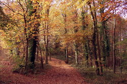 Autumn in Lady Hill Wood |
|
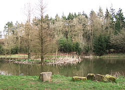 The pond in the wood |
After 100 metres go through a metal gate on to a track marked “Kitty Beech Road”. Follow this down through Lady Hill Wood, crossing over the first intersection. Turn left at the junction with the next track and cross the stream. Follow the track to the left and after 25 metres go through a metal gate on the right. Turn 90° right and after 25 metres cross a stile and go straight ahead through trees. After a short distance cross a stile and go ahead with trees and a pond on the right. | |
|
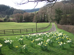
Cross another stile and head across the field to 2 adjacent power-line poles. Continue in the same direction and go through a metal gate (often left open). Head half left across the next field to a metal gate (often left open) in the hedge, which appears as you climb the slope. Head half right across the next field to a line of trees. On reaching a small stream, follow it to the left for a short distance until you find a small wooden bridge (one railway sleeper). (NB: This is invisible until you are very close as it is in a dip.) Cross the bridge and after 10 metres turn left. After 40 metres go through a narrow gap between bushes on the right and cross a stile (an adjacent stile at this point has collapsed). Go straight ahead with trees on the right. Head for a telegraph pole, then right to a small metal gate next to a garage. Turn left on the lane and soon swing left where a narrow lane goes straight on. |
||
| Keep straight on at the next junction,
where there is a house called “Ty Mynydd”. Go downhill and soon
cross a stile on the left at a waymark post. Go straight ahead, passing
a house, and step over a small wooden gate by means of 2 tree stumps, eight
metres to the left of a large tree. Turn right and go down the drive. (This
is a public right of way though it appears otherwise.) Turn left on the
lane and immediately left on another where there is a yellow gravel bin.
. (See below for a much shorter return route from this point.) |
||
|
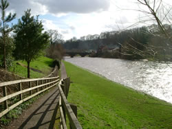
Go downhill and just beyond the lane on the right marked "Unsuitable for heavy goods vehicles" and before the large green shed, cross a stile on the right. Turn left and at the corner of the field cross a stile and continue alongside a wire fence and stream to the corner of the field. Cross a stile, then take the path parallel to the stream. At the far left corner of the field cross a small wooden bridge and stile. Turn right and then half left across the field, heading for tall conifers at the left edge of Ash Wood. Climb the deforested hillside on a steep, grassy track, staying close to a very overgrown area on the right. Turn right at a small clearing before the brow of the hill and left on a narrow path. After 25 metres cross a stile and turn left along the field edge. Follow the field edge a short way round to the right. Cross a stile and immediately another on the right. Turn left and go downhill with a hedge on the left. Cross 2 stiles at the corner of the field and turn left on a lane. After 90 metres cross a stile on the right, then go straight across the field to cross another stile. Head for the far left corner of the field and cross a stile. Turn right on the busy road and after 100 metres take a broad track on the left, where there is a green footpath sign. Go through a metal gate (sometimes left open) and follow the track to the left and then right by a corrugated iron barn. Continue on a broad track, with a huge array of solar panels on the left. After passing a wooden chalet on the right, go through a metal gate and follow the track. At the end of the solar panels enclosure go straight down the field, staying close to trees on the right. Where the line of trees ends, continue in the same direction until reaching the river. (NB: This is where the O.S. map and the Monmouthshire Council Website show the path but sometimes crops are planted over it, which can make it difficult to choose the best route.) Turn left on the riverbank and follow the obvious path to where it meets the road. Cross a stile and turn right. Walk parallel to the river, back into the town centre, turn left at the T-junction and return to the town square. (A short optional detour is to take the path through the kissing gate just before the veterinary practice and walk along the river bank (Conigar Walk) as far as the bridge. Take the path up to the road and turn left to return to the town square.) |
||
|
|
|
Shorter
return route
from point noted
above: |
|
A
laminated A5 card showing this walk route, along with photographs, can
be easily ordered here.
The walk can be ordered more cheaply in digital format (PDF file) on the alternative Order Form. |
return
to top >>>
Page last updated 04.04.26